Serra de Tramuntana
Back to all places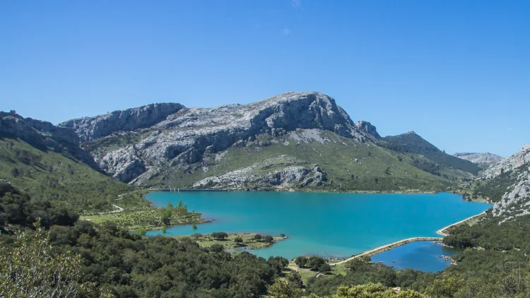
Nestled on the captivating island of Mallorca, the Serra de Tramuntana is a majestic mountain range, stretching from southwest to northeast and forming the island’s northern spine. Known for its breathtaking landscapes and steeped in history, this region was honored with World Heritage Status by UNESCO on June 27, 2011, in recognition of its extraordinary physical and cultural significance.
Dominating the skyline, the range’s highest peak, Puig Major, rises to 1,436 meters, making it the tallest summit in the Balearic Islands. Close contenders include the Penyal de Migdia at 1,398 meters and Puig de Massanella at 1,364 meters.
The range also conceals Mallorca’s deepest cave, Cova de sa Campana, which plunges to -358 meters, and the deepest underground lake at -334 meters.
Climate-wise, the Serra de Tramuntana is notably wetter compared to the rest of Mallorca, receiving up to 1,507 mm of rainfall annually. This, coupled with its higher altitude, results in a cooler environment with occasional wintertime snowfalls.
The Serra de Na Burguesa marks the southern edge of this dramatic range. Amidst the tranquil peaks, the Coll de Cal Reis stands as a mountain saddle, providing access to the striking beach town of Sa Calobra via the renowned Ma-2141 highway, a favored route for road cyclists.
For history enthusiasts, this enchanting area also boasts ancient settlements and watchtowers used to guard against pirate invasions, weaving together a tapestry of natural splendor and rich historical intrigue.
Legends speak of hidden treasures buried within its craggy valleys, enticing adventurers to discover its mysteries from yesteryears.
Photo: Stein Arne Jensen
39.82126, 2.80465